Hi.
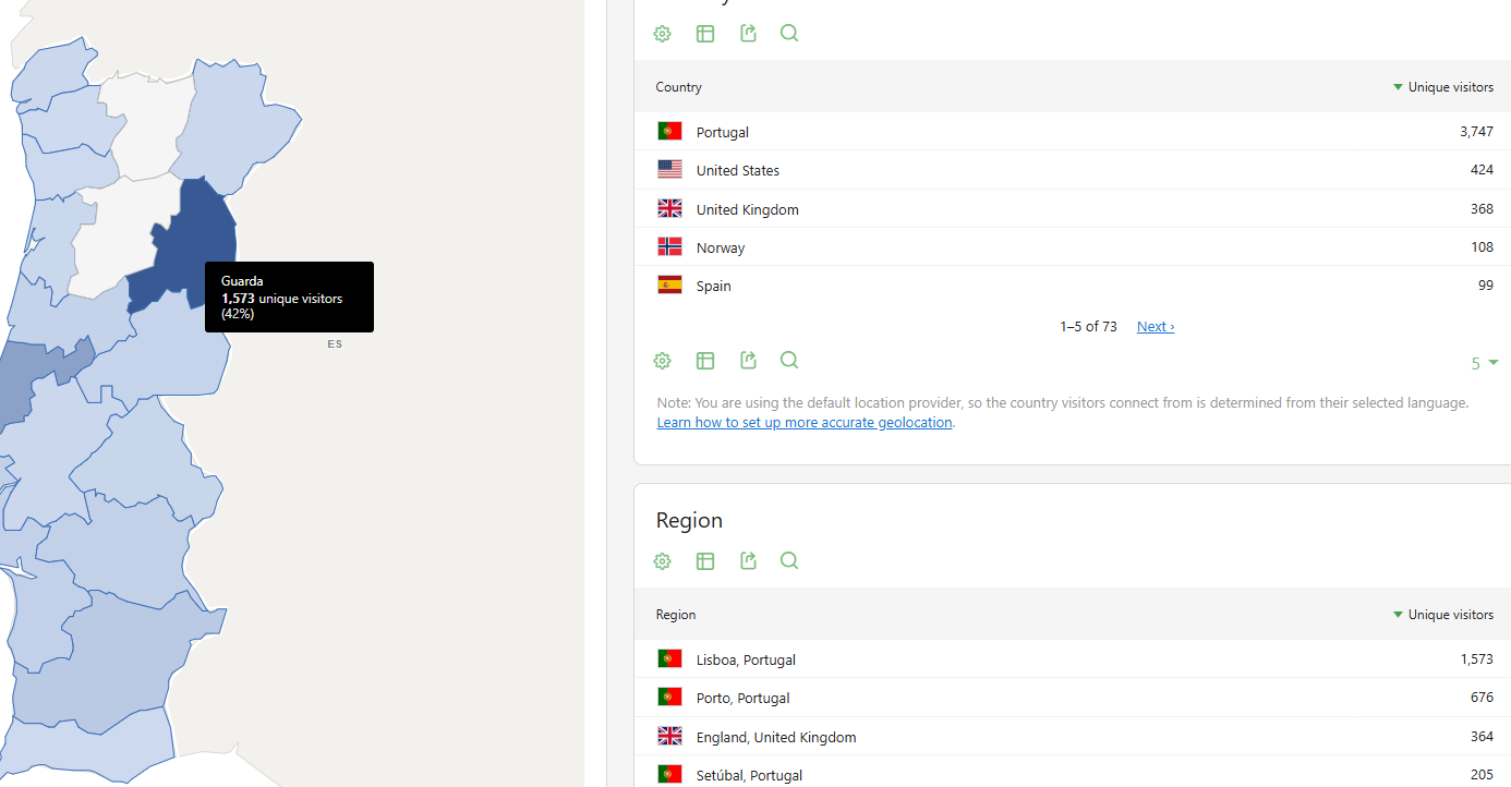
While looking at the visitors map regarding Portugal, all the regions seem to be drawn in the wrong place.
For instance, visits for Lisbon (PT-11) are drawn in Guarda (PT-09)
Clicking on the region, shows the value used to “paint” the map, i.e., clicking on “Guarda” shows “Lisbon”
This happens with every region.
On the visitors real-time map the information is displayed correctly.
The offset you describe matches a code-scheme mix-up: in the old FIPS 10-4 numbering Portugal’s district 11 is Guarda, while in ISO 3166-2 PT-11 is Lisboa. So the region map seems to be matching ISO codes from geolocation against shapes keyed by FIPS numbers, which would shift almost every district. The real-time map plots coordinates rather than region codes, which fits with it showing the right place.
Which geolocation provider are you using (DB-IP, MaxMind GeoIP2, etc.) and which Matomo version? That would help confirm it’s the map data rather than the location database, and it’s probably worth a GitHub issue with that screenshot.
Hi Mirza.
We’re running Matomo 5.14.1
We’re also using Campus GeoIP with “DBIP or GeoIP 2 database and MaxMind’s PHP API”